Daniel Ibañez, Renia Kagkou
in Daniel Ibañez, Jane Hutton and Kiel Moe (ed) Wood Urbanism: From the Molecular to the Territorial, Actar (December 2019)
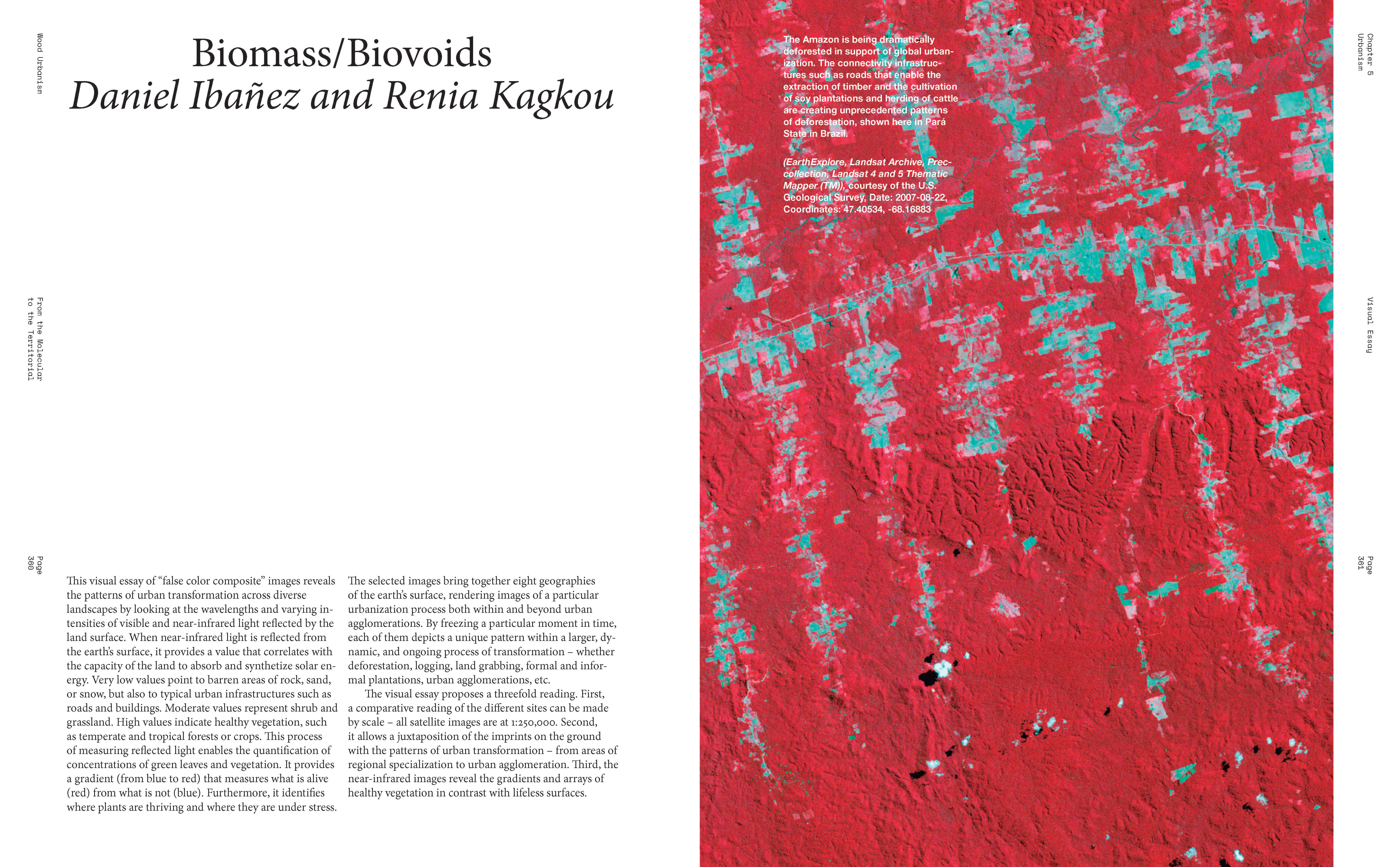
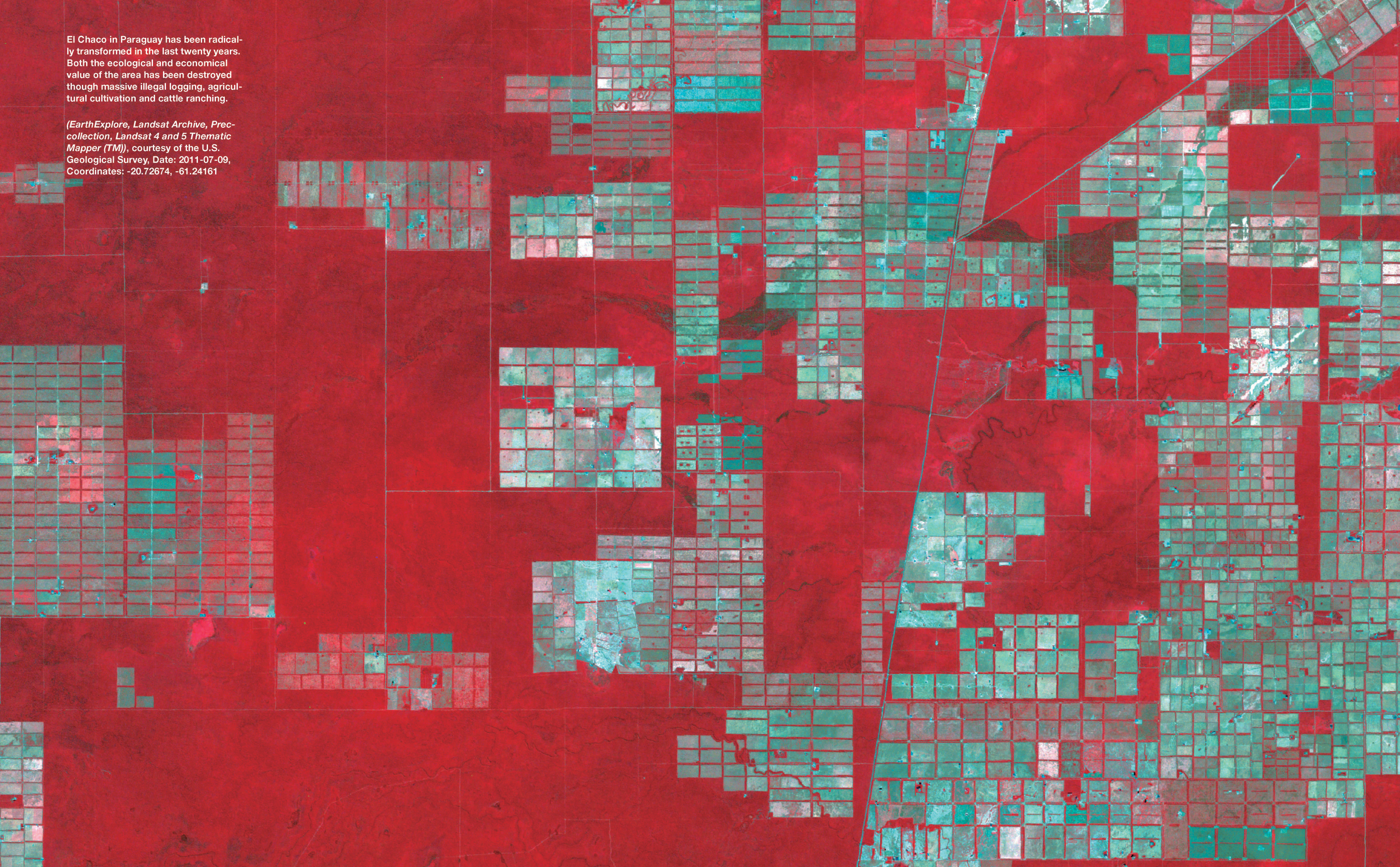
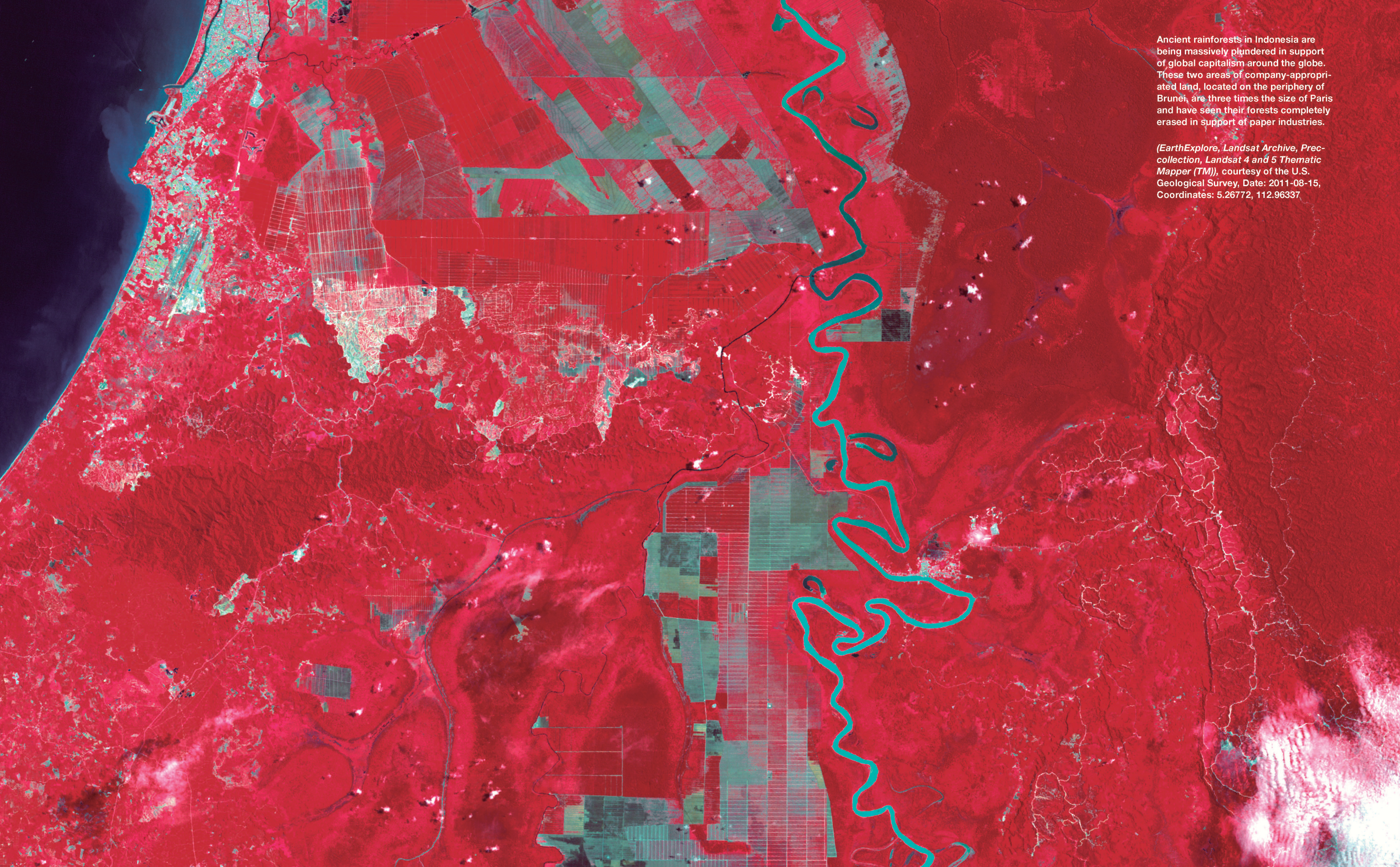
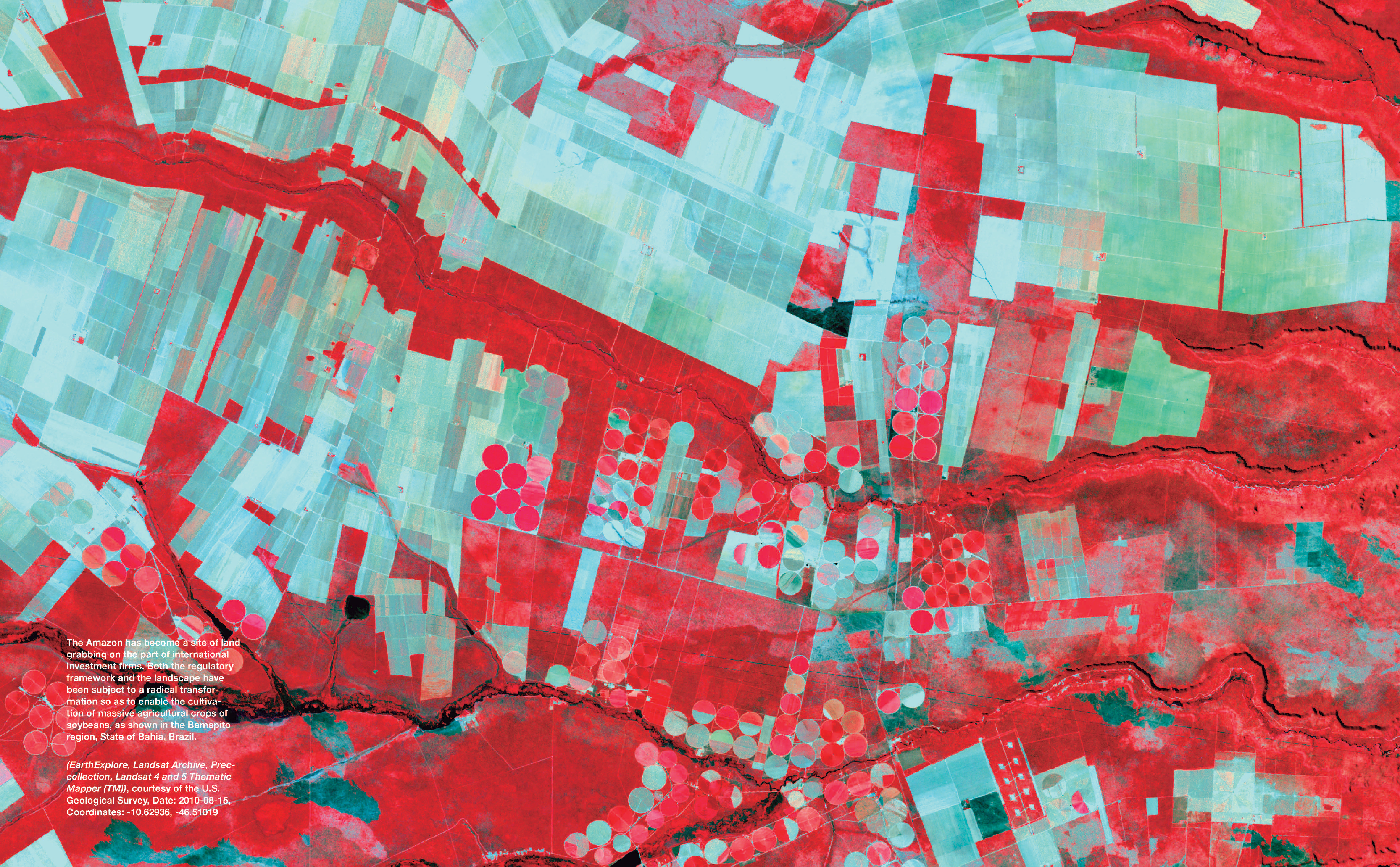
This visual essay of “false color composite” images reveals the patterns of urban transformation across diverse landscapes by looking at the wavelengths and varying intensities of visible and near-infrared light reflected by the land surface. When near-infrared light is reflected from the earth’s surface, it provides a value that correlates with the capacity of the land to absorb and synthetize solar energy. Very low values point to barren areas of rock, sand, or snow, but also to typical urban infrastructures such as roads and buildings. Moderate values represent shrub and grassland. High values indicate healthy vegetation, such as temperate and tropical forests or crops. This process of measuring reflected light enables the quantification of concentrations of green leaves and vegetation. It provides a gradient (from blue to red) that measures what is alive (red) from what is not (blue). Furthermore, it identifies where plants are thriving and where they are under stress.
The selected images bring together eight geographies of the earth’s surface, rendering images of a particular urbanization process both within and beyond urban agglomerations. By freezing a particular moment in time, each of them depicts a unique pattern within a larger, dynamic, and ongoing process of transformation – whether deforestation, logging, land grabbing, formal and informal plantations, urban agglomerations, etc. The visual essay proposes a threefold reading. First, a comparative reading of the different sites can be made by scale – all satellite images are at 1:250,000. Second, it allows a juxtaposition of the imprints on the ground with the patterns of urban transformation – from areas of regional specialization to urban agglomeration. Third, the near-infrared images reveal the gradients and arrays of healthy vegetation in contrast with lifeless surfaces.
