Questioning the geographical organization of Alternative Food Systems in the U.S.
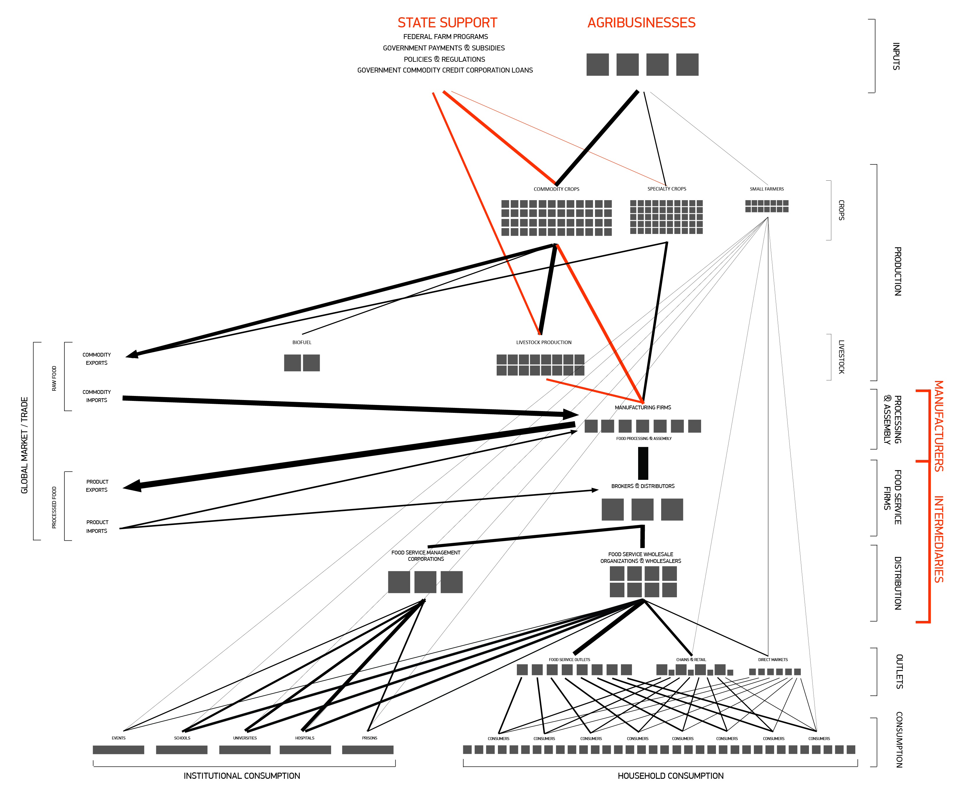
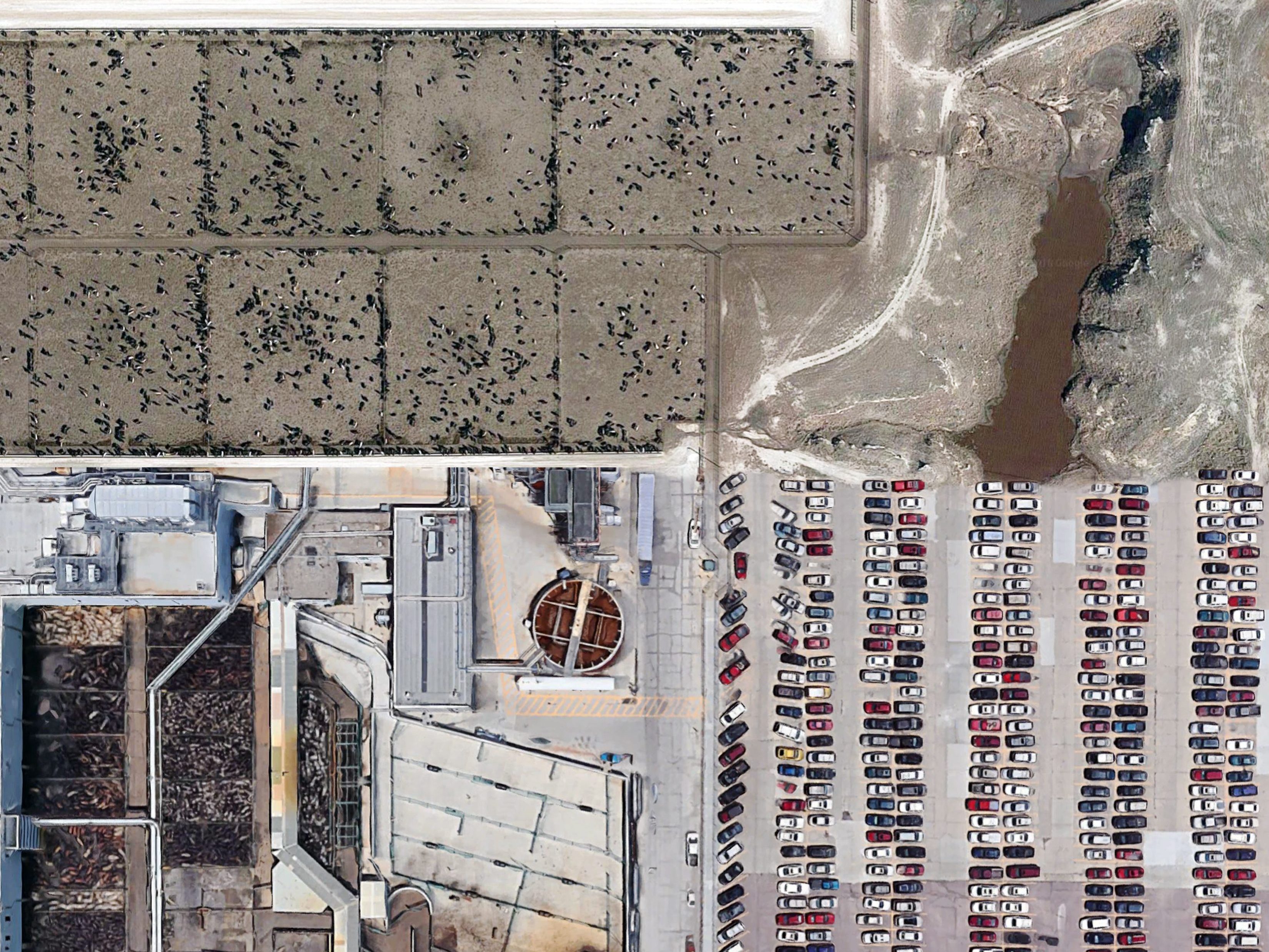
Industrial Food Systems:
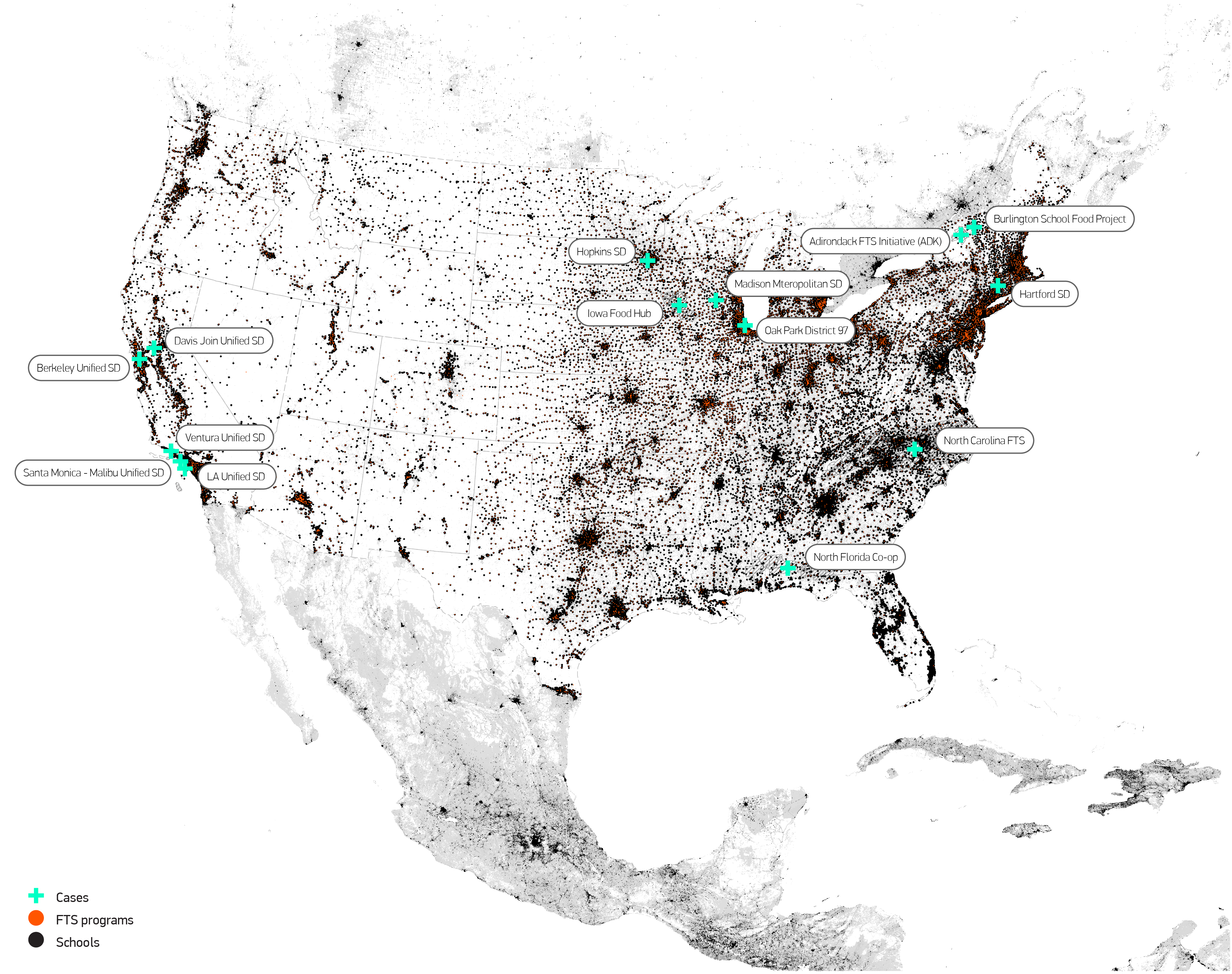
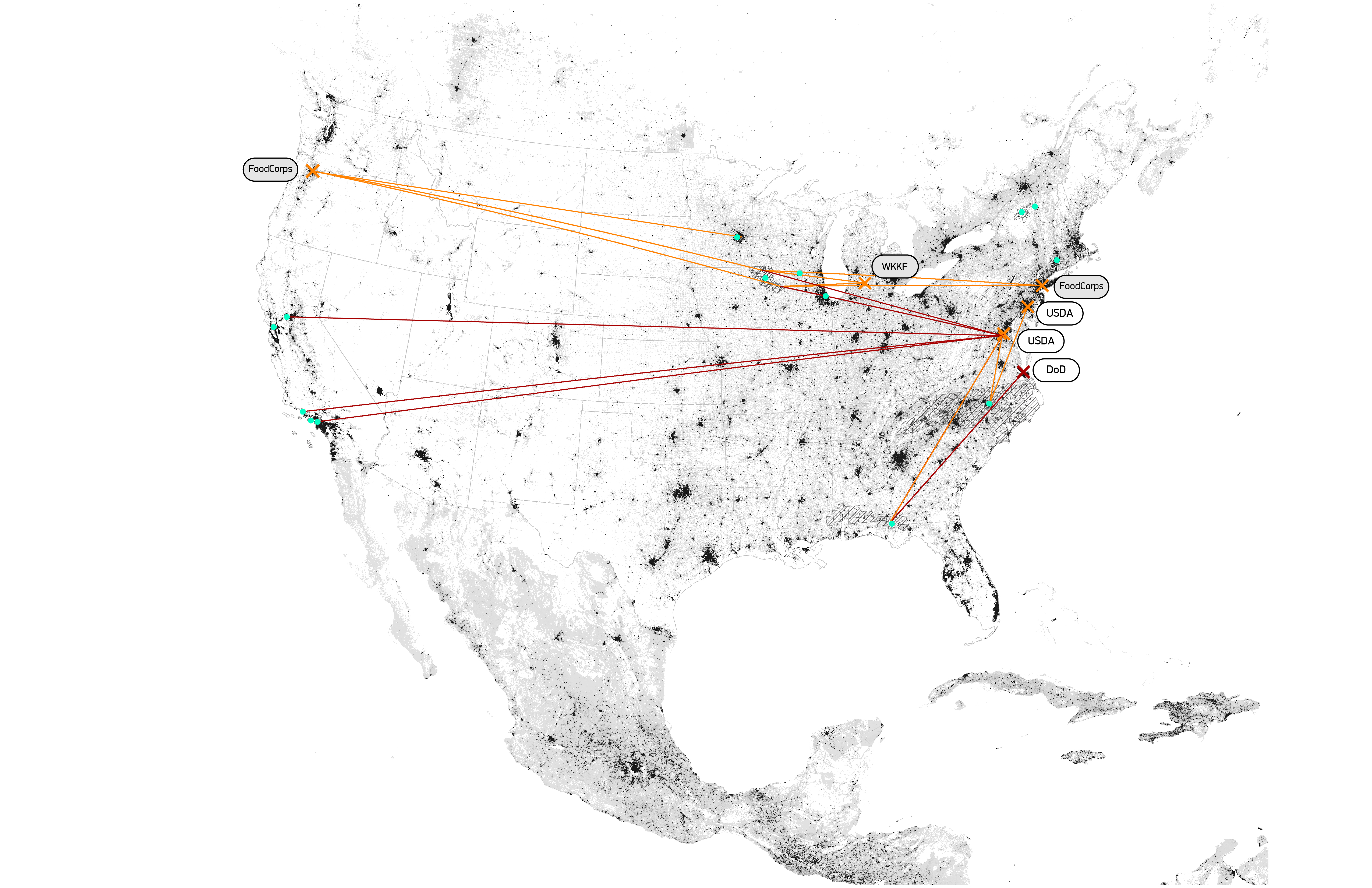
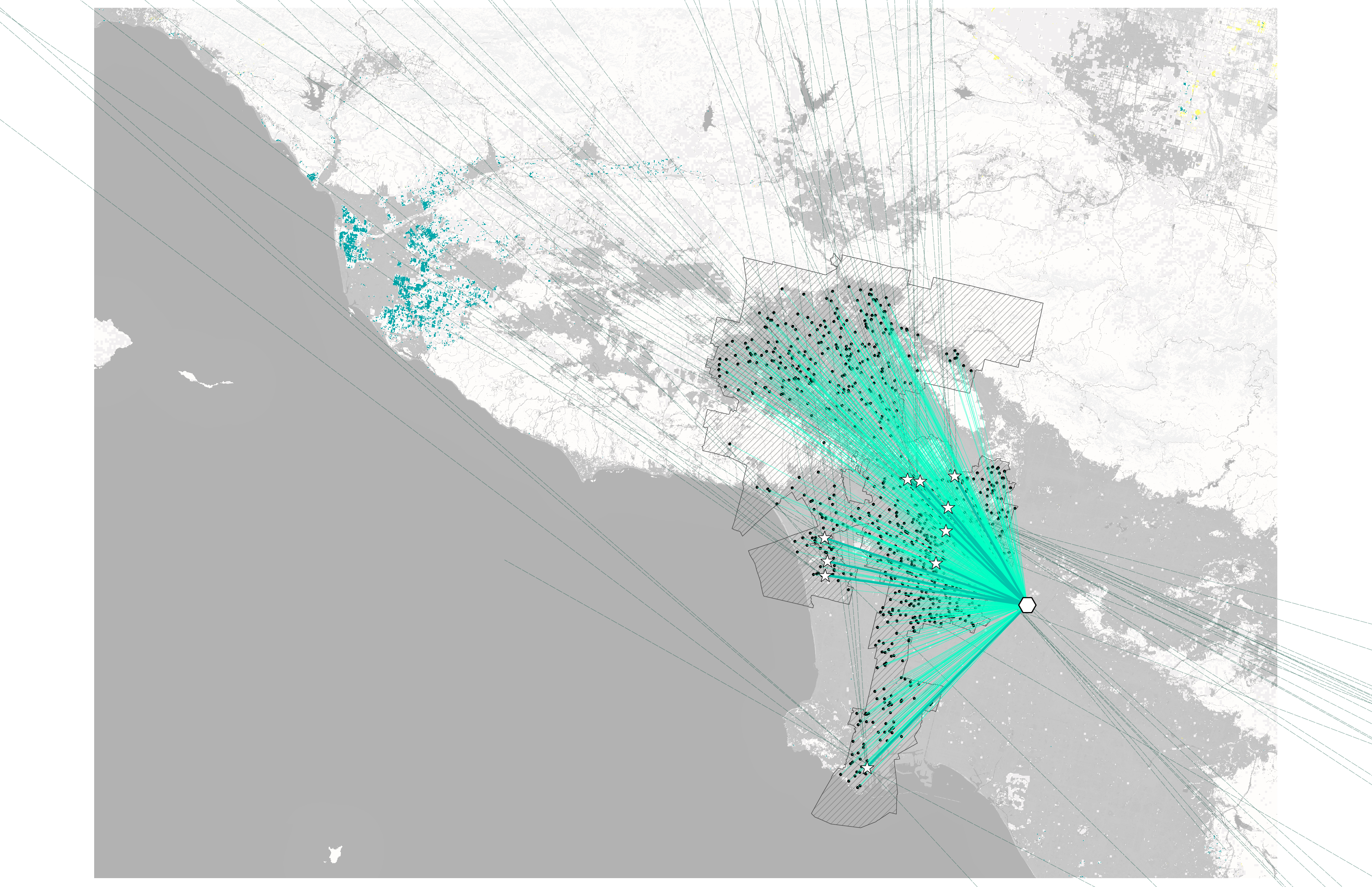
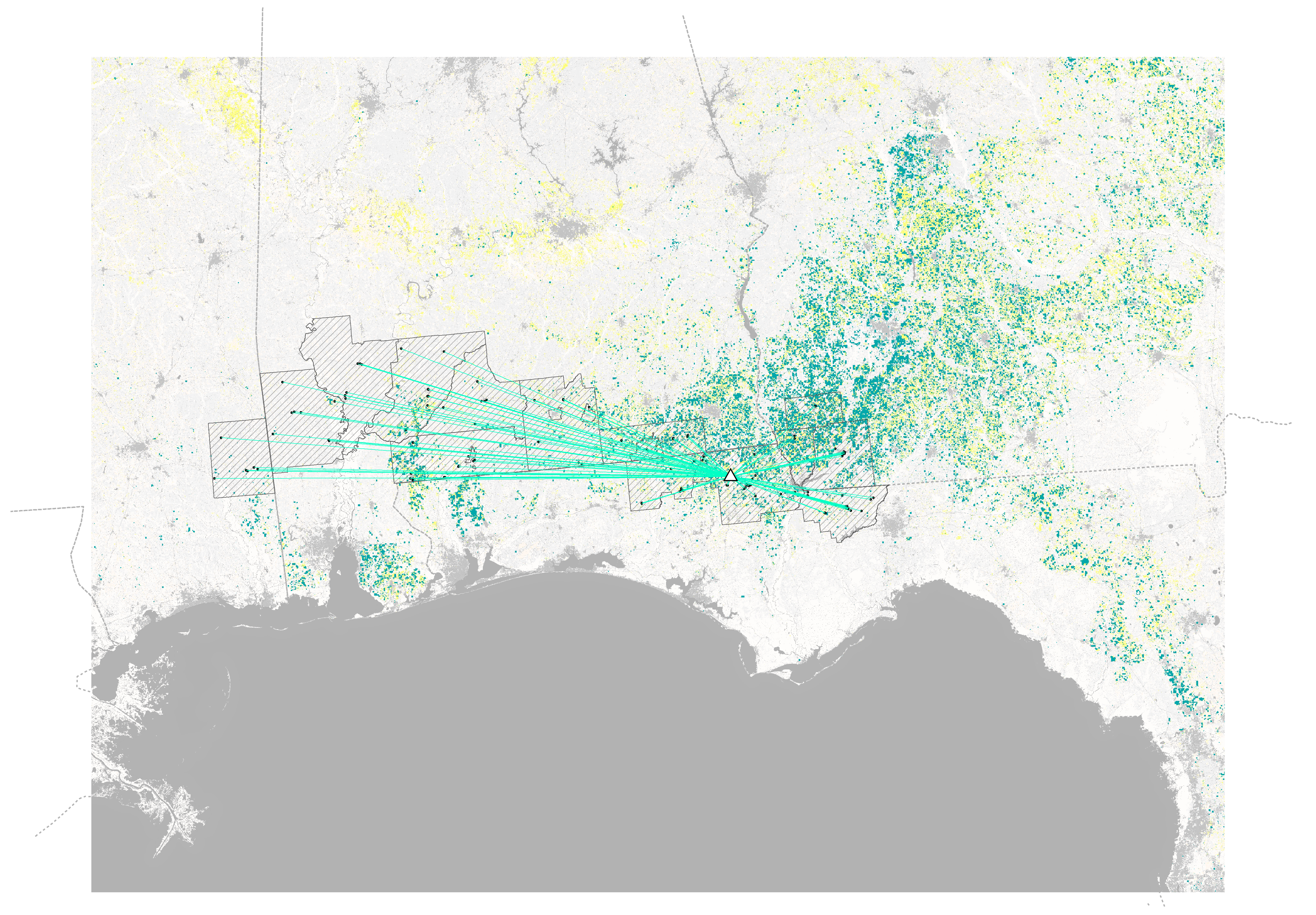
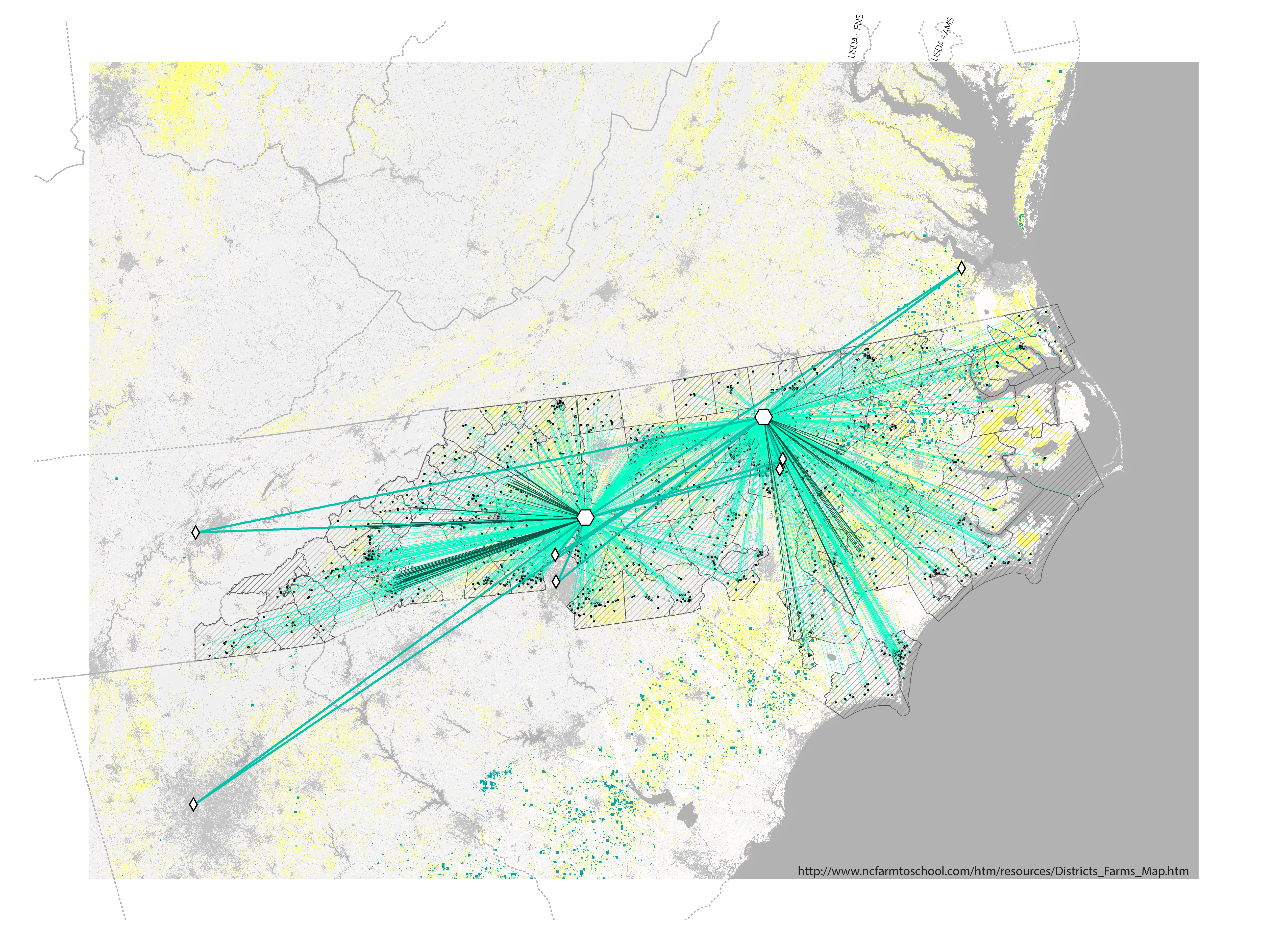
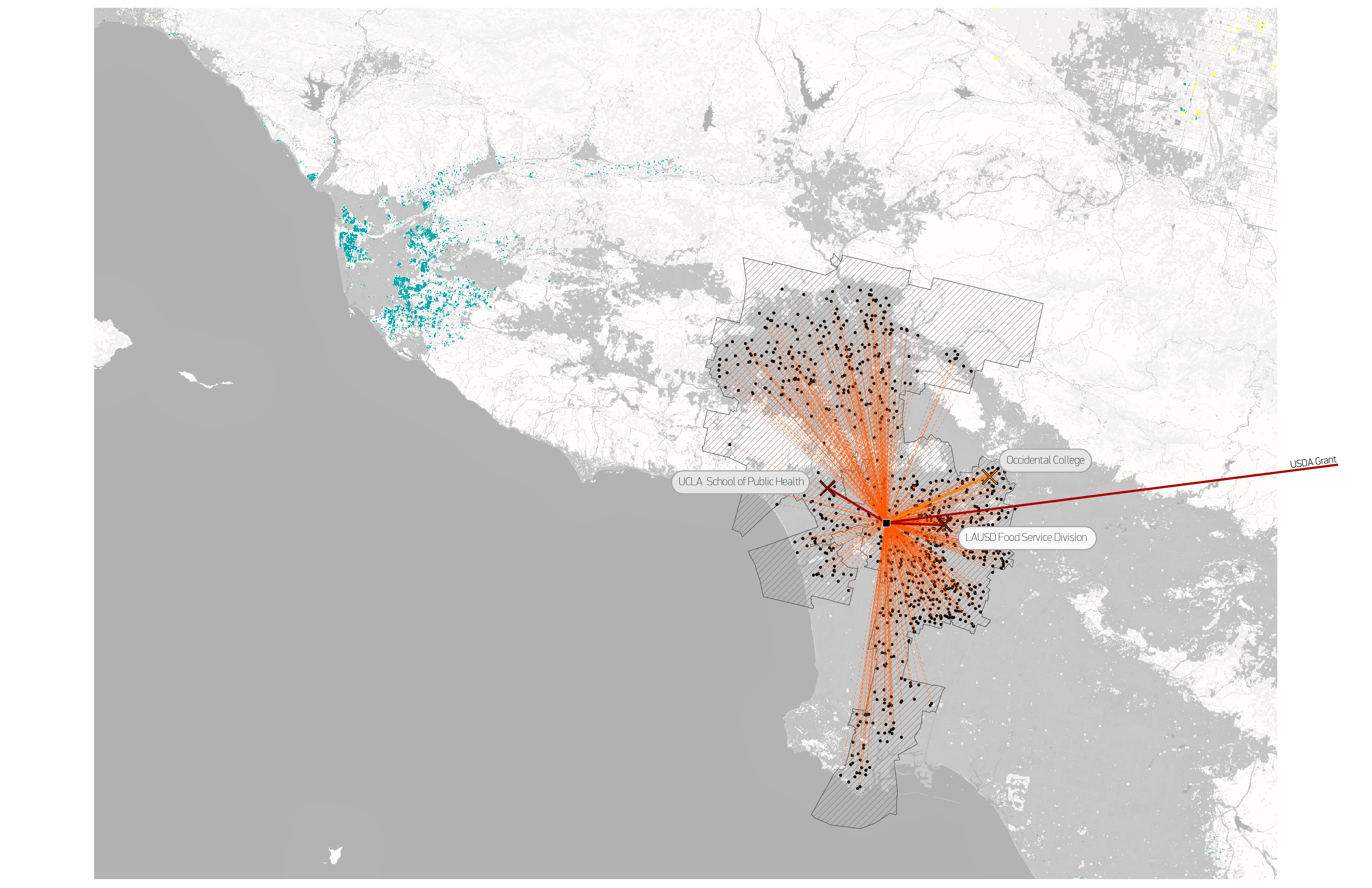
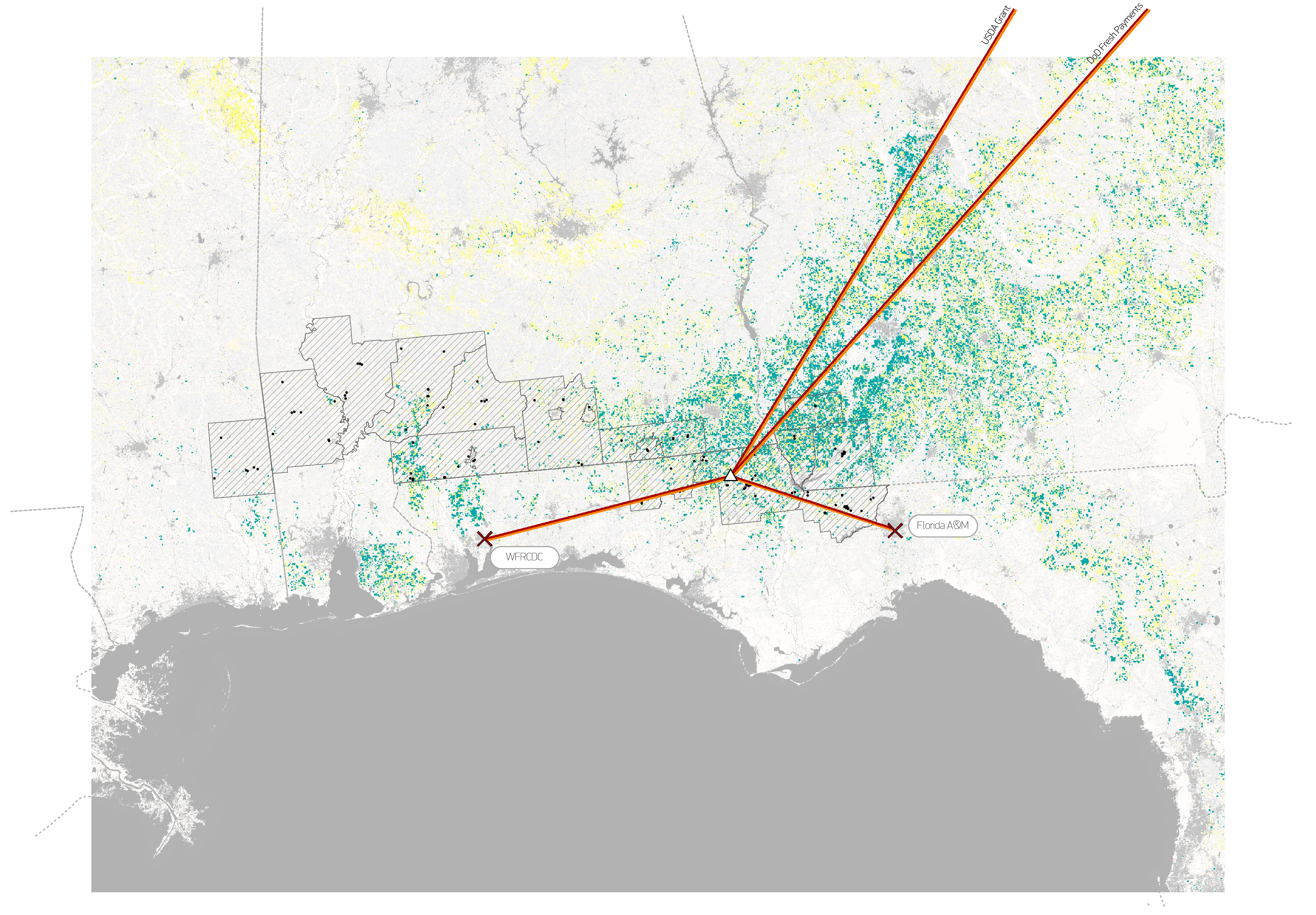
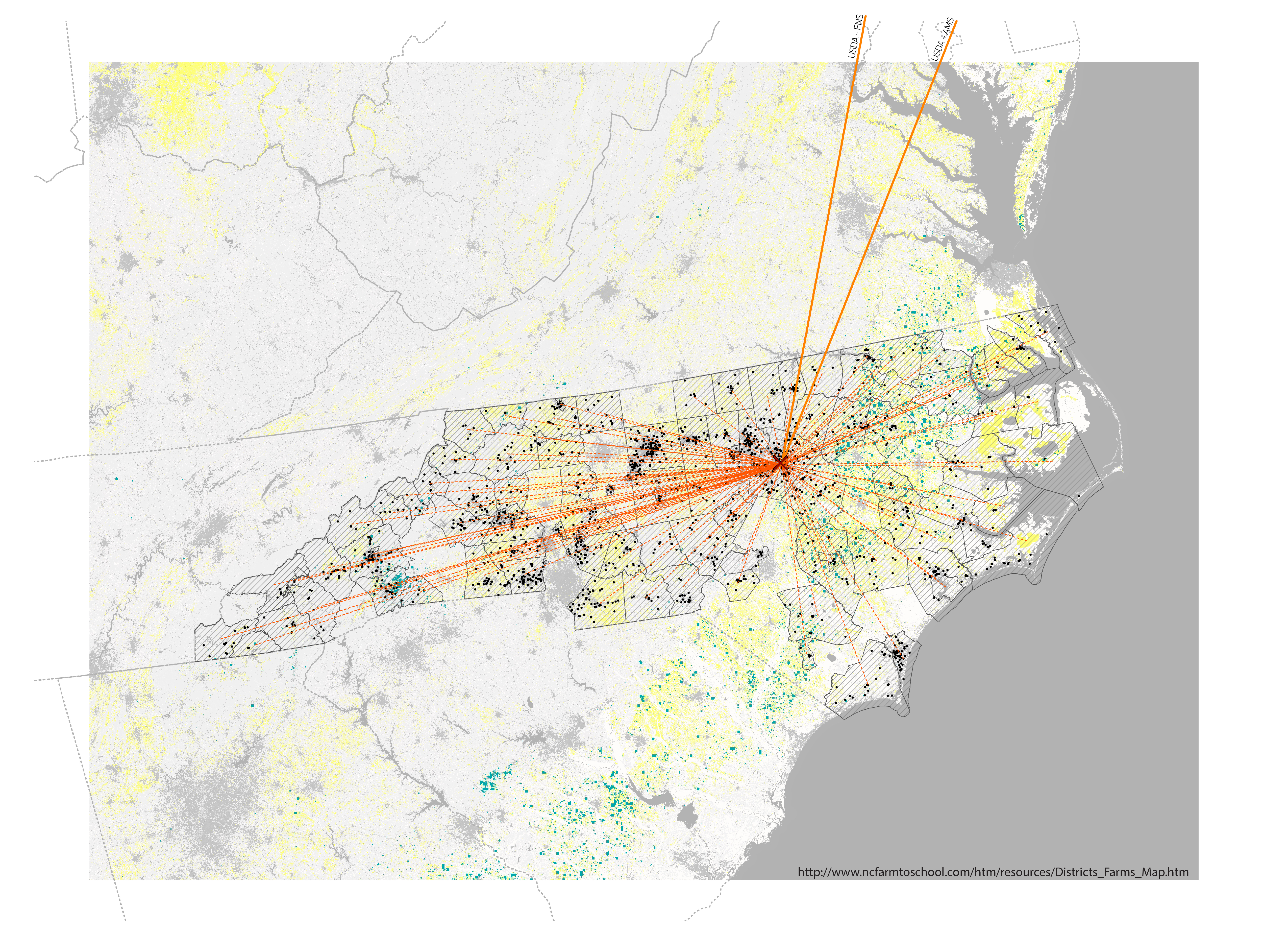
Farm To School Alternative Systems:
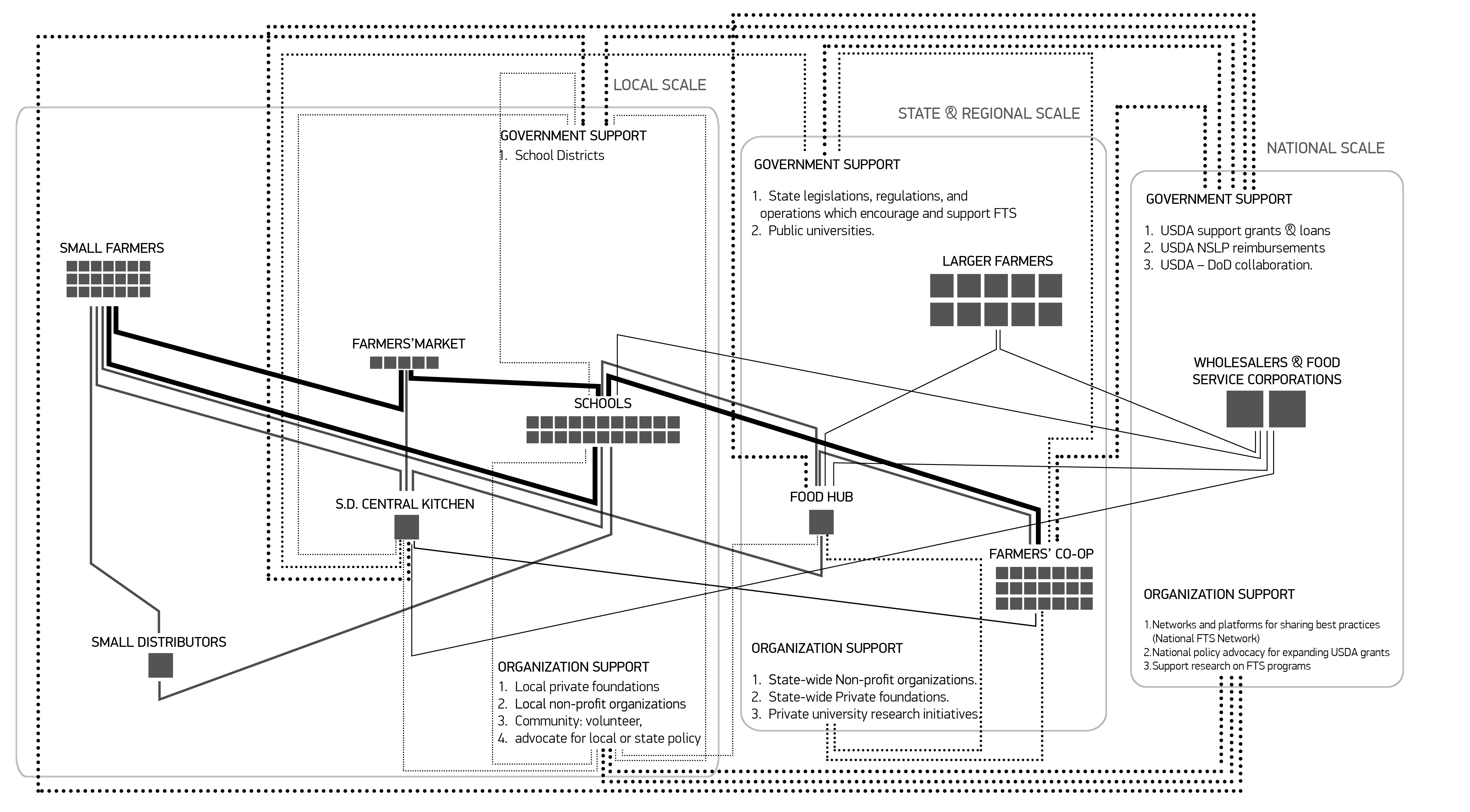
Since the 1960’s various decentralized local Alternative Food Systems (AFS) have emerged in reaction to the externalities and limitations of the modern corporate agro-food system: its environmental inefficiencies, capital distributional inequalities (as wealth and power has been transferred from farmers and consumers to big capital), and nutritional inequalities and food safety issues affecting lower income groups. In both academia and practice, localizing food systems is largely celebrated as a counter-movement to global corporate food systems, due to the capacity of AFS to escape the corporate value chain, through direct marketing, or shorter and sustainable food supply chains.
However, this fetishism of the “local” as an ontological category that opposes the “global” should be more critically unpacked, as AFS lay upon a multi-scalar and uneven geographical, regulatory, and funding landscape, which significantly determines their success or failure. The inherited landscape upon which AFS are structured is characterized by opportunity disparities: where institutional support and resources are abounded AFS will proliferate, while in other areas AFS will barely endure. Therefore, these alternative initiatives in many cases reproduce, instead of challenging patterns of uneven development.
Based on a combination of extensive theoretical inquiry and empirical investigation, this research argues that AFS should not be defined by their scale of practice but rather by their ability to up-scaled, inclusive, economically viable, and sustainable alternative structures that prioritize social needs. Instead of being necessarily fixated at the local scale, it argues for exploring the potentials for upscaling alternative food systems, and sketches the major institutional, economic, and geospatial trajectories for such an investigation.
Cartography by the author based on data from:
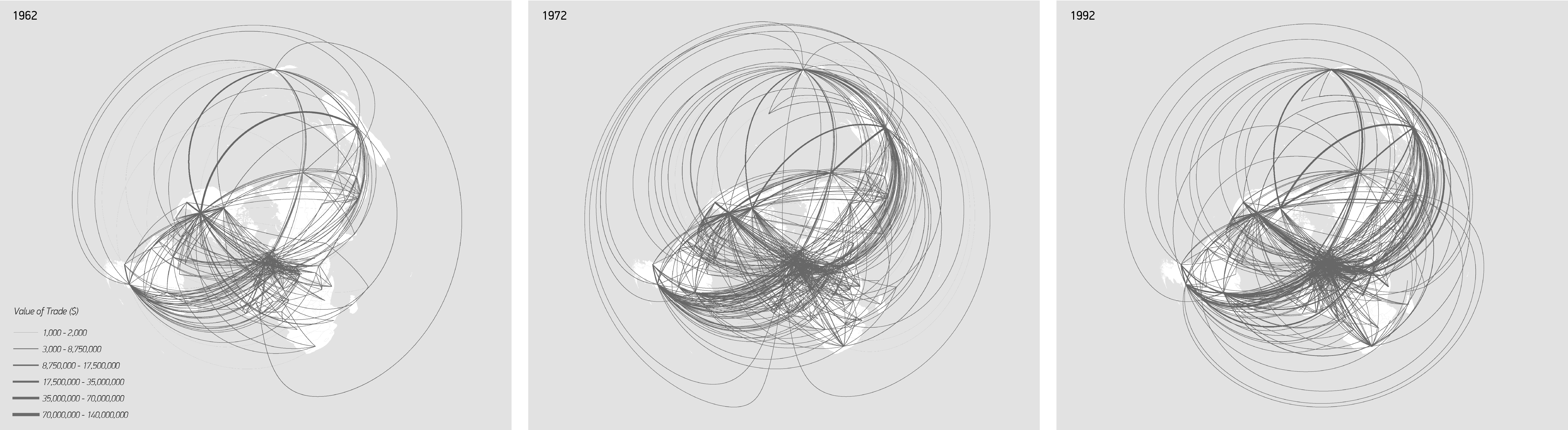
- Feenstra, C., R., Lipsey, E., R., Deng, H., Ma, C., A., Mo, H., (2005). World Trade Flows: 1962-2000. – International Trade Data, NBER-UN world trade data. National Bureau of Economic Research.
- Falcone, A., J., LaMotte, E., A. (2016). National 1-kilometer rasters of selected Census of Agriculture statistics allocated to land use for the time period 1950 to 2012. U.S. Geological Survey.
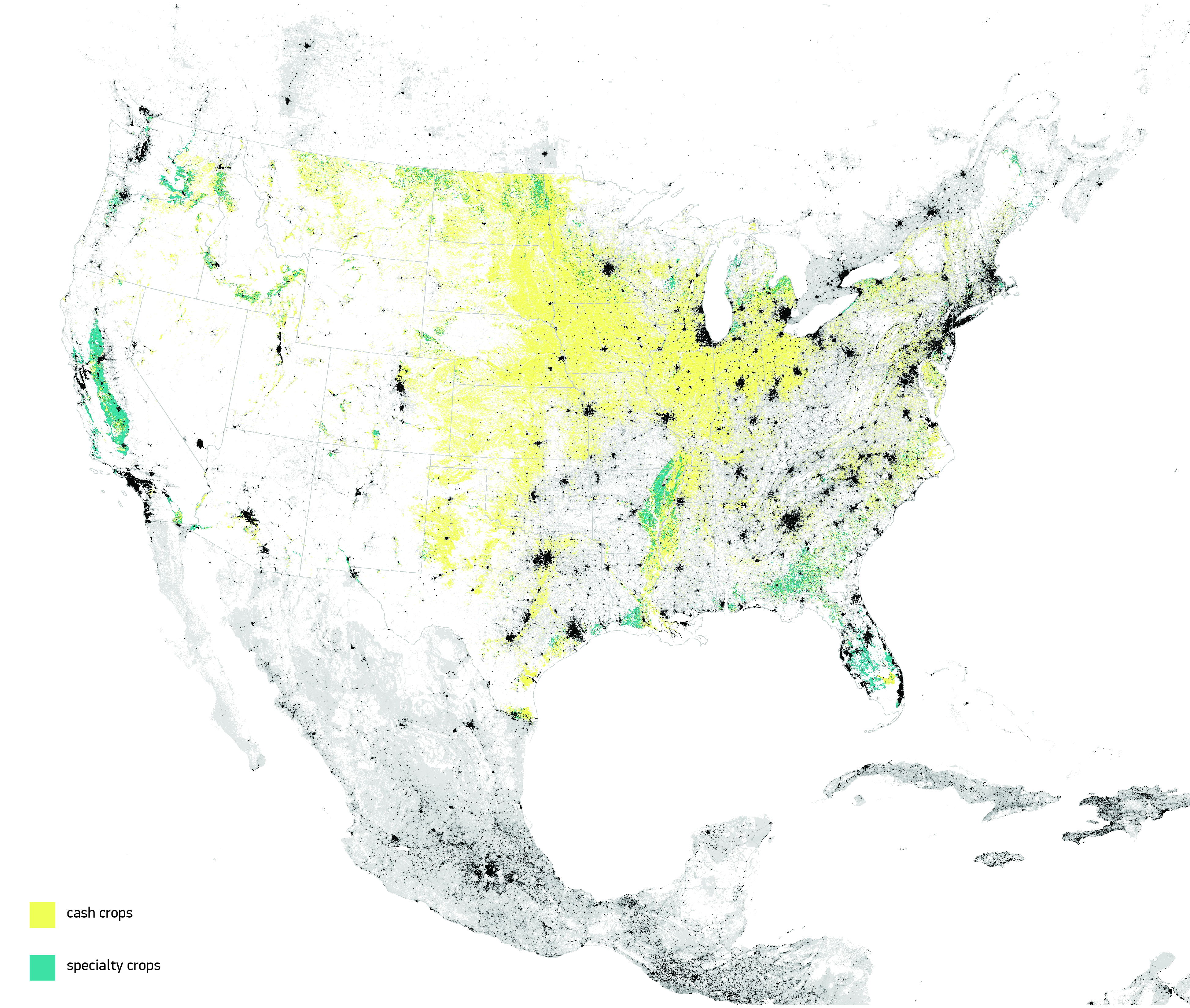
- (2015). Crop-Scape – Cropland Data Layer. United States Department of Agriculture, National Agricultural Statistics Service ; (2012) 2012 Census of Agriculture. United States Department of Agriculture, National Agricultural Statistics Service.
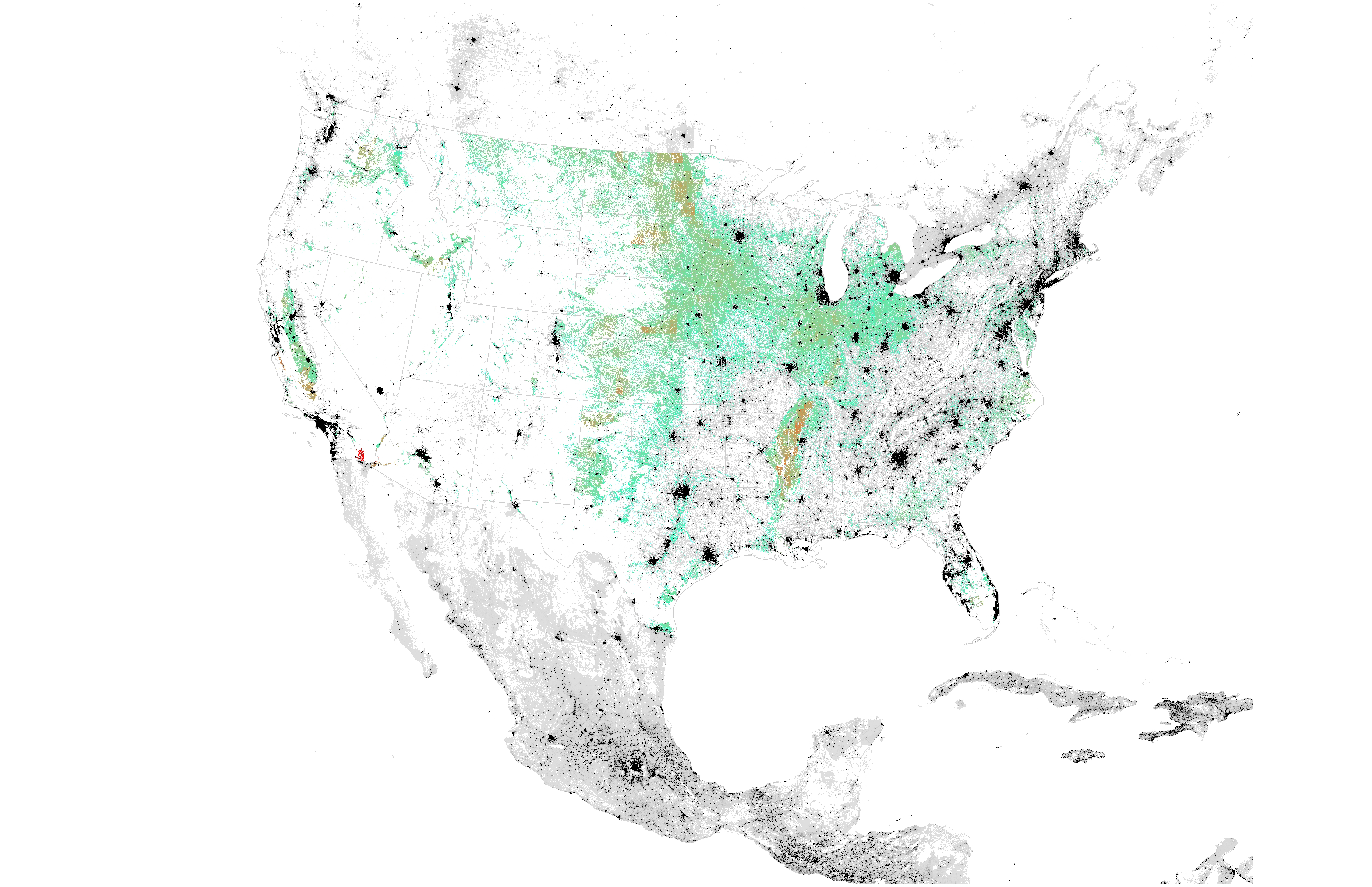
- (2015). Common Core of Data Free Lunch. National Center for Education Statistics; (2015) 2015 composite school district shapefiles. US Census Bureau; (2011). NLCD 2011 Land Cover. US Geological Survey.
- (2016). Farm-to-School Census. United States Department of Agriculture, National Agricultural Statistics Service; (2011). NLCD 2011 Land Cover. US Geological Survey.
- (2016). Farm-to-School Census. United States Department of Agriculture, National Agricultural Statistics Service; (2011). NLCD 2011 Land Cover. US Geological Survey.
